


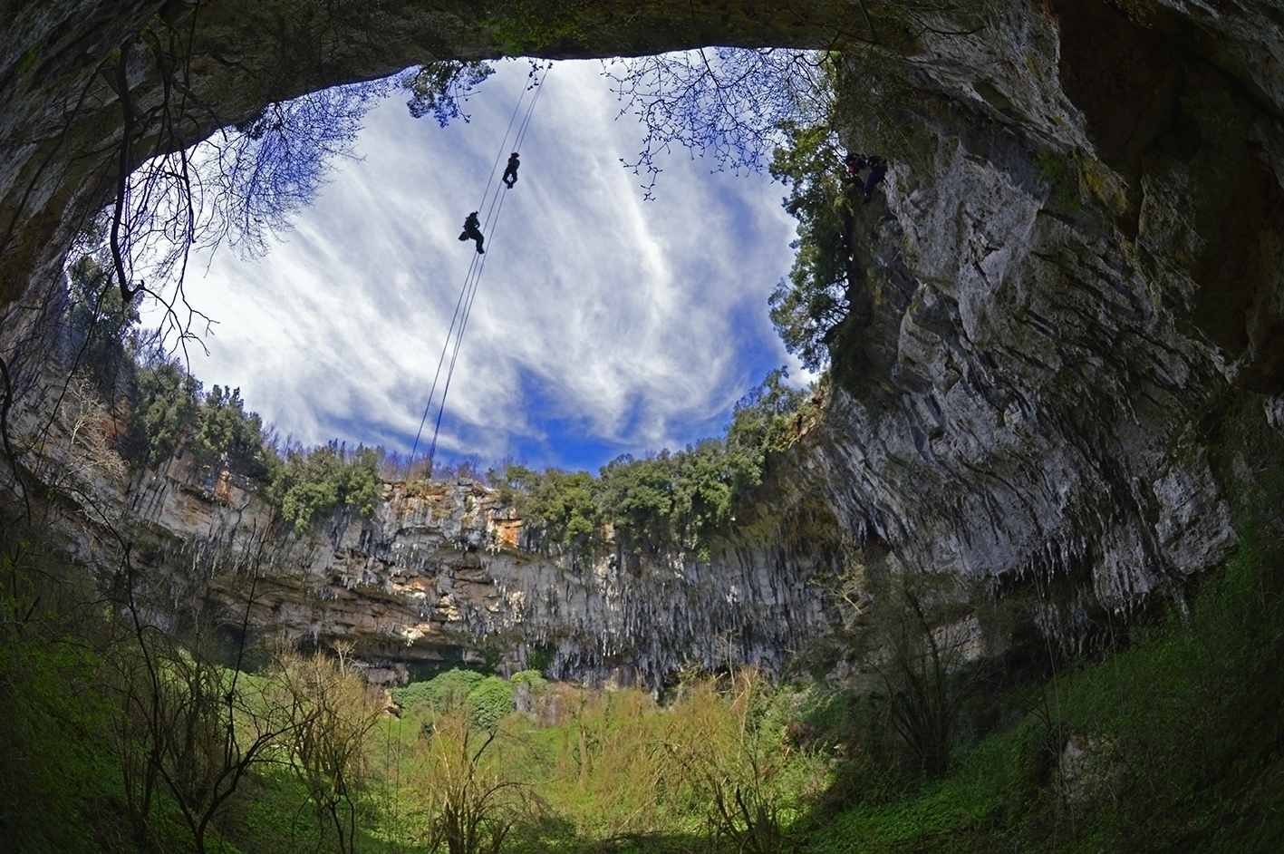
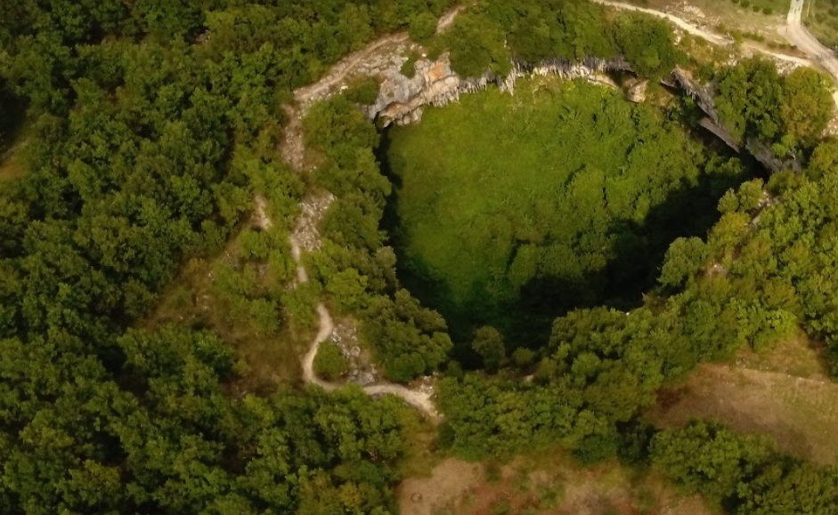
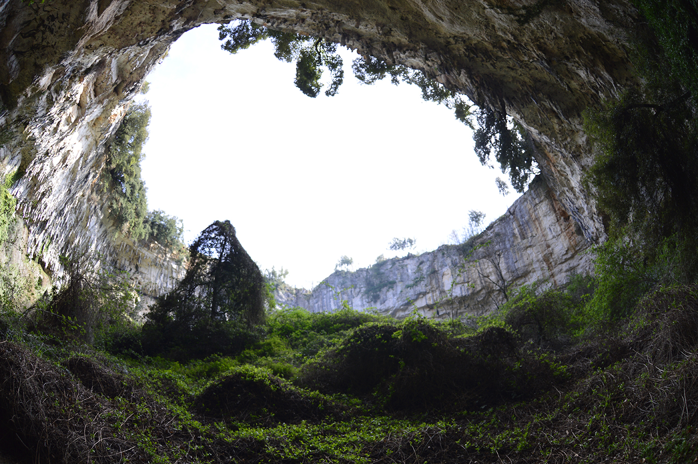
D’Antullo pothole is a karst phenomenon near Collepardo (Frosinone, Lazio, Italy), 13°22’06’’ long E, 41°46’12’’ lat N, 660 m above the sea level. The pothole is about 120 m wide and 38 m deep, with vertical walls and a dense woody and shrub vegetation inside. The peculiar structure and the geological history of the site stimulated the interest about its biodiversity.
D’ANTULLO PHOTOLE: HISTORY AND MEMORIES
AIM OF THE STUDY
Although the D’Antullo pothole is well known, our research will be the first on its natural history. The pothole has been explored since 1800 first by Italian naturalists, then, among others, by the French speleologist Alfred E. Martel in 1903 and by CSR since 1928. Our research will be focused on microbial, plant and animal diversity of the site. A palynological analysis of sediments will also be carried out. Seasonal variation of habitat features will be investigated by dataloggers. Seasonal surveys by trained cavers and scientists of the CSR, some of them affiliated to local universities (Roma, Viterbo) will be carried out. Plant diversity will be investigated by standardized direct/indirect collecting methods. A herbarium of the species will be set up. Animal diversity will be sampled by Malaisie traps, pitfall traps, litter reducers, soil washing and Berlese funnels, as well as by sweeping nets, butterfly nets, clap nets, camera traps and visual sampling. Attention will be given to locate and sample microbial films on the rocks. Speleological exploration and waste removing will be carried out. Results of our studies will be spread among the local community.
The funding will be used both for the vertical equipment required to access the bottom, the walls, the tree trunks, and explore unreachable cavity entrances, as well as for the technical instruments and analysis necessary to achieve the aims of the research.
MAIN OBJECTIVES
Objective 1. Short-term objective. Development of a database (DB) on bibliographic, cartographic, photographic and other archival references and documents about the study site and adjacent areas, with a focus on environmental, ethno-anthropological and exploratory studies. Success measurement will be the total items listed in the DB deposited in the library of the CSR and made accessible to the public.
Objective 2. Long-term objective. Assessment and monitoring of the D’Antullo pothole biodiversity by means of direct and indirect sampling. Recording of habitat parameters by means of dataloggers.
Success measurement will be the number of records collected through samples. Development of a DB of all plant and animal taxa registered in the study area, and their relevant traits.
Objective 3. Long-term objective. Analysis and processing of the collected data with emphasis on the features of this unique underground photic habitat and the corresponding ecosystem.
Success measurement will be the submission of papers to peer reviewed international scientific journals (where the role of the main sponsor will be acknowledged).
Objective 4. Long-term objective. Organization of cultural events in the frame of the International Year of Caves and Karst 2021.
Success will be evaluated by the number of the organized initiatives and the number of people intervened.
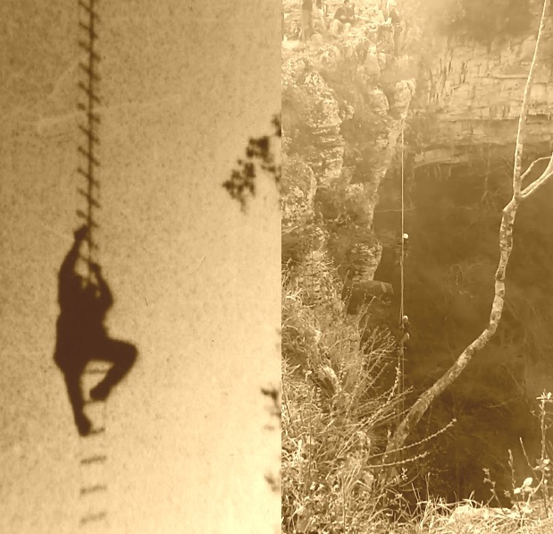
D’Antullo pothole has a depth of 65 m and a circumference of over 300 m. In order to carry out the study of the geosite, a revision of the previous anchors and the preparation of new routes for the descent are required, possibly by means of removable anchoring equipment to avoid excessive impact on the rock. The standard equipment for caving, tree and free climbing will be used. Indeed, research will be extended to the tree canopies and the pothole walls. Beside scientific oriented sampling we aim to place cable ways to remove litter and garbage as a contribution to clean this remarkable geosite.
Our project will be publicly launched in the frame of the initiatives of International Year of Caves and Karst 2021-2022. The project develops in four phases across 18-24 months since the recovery of financial resources:
1) collection of bibliographic resources (3 months); the material will be listed on the CSR web site;
2) selection of sampling sites (2 weeks); preparation of the climatic station (1 week); seasonal sampling in situ on flora, fauna and palynological coring; photo and video recording (18-24 months);
3) development of a database of animal and plant species; palynological profiles; characterization of microbial films, elaboration of the results (6 months);
4) dissemination of the results, public involvement in the initiatives undertaken (last 2 months).
The project is led by CSR and Sylvatica.
During the project, the subjects with whom negotiations are currently in progress may join, with sponsorship or economic collaboration: Regione Lazio administration; LAZIOcrea S.p.A.; XII Comunità Montana dei Monti Ernici; GAL (Gruppo d’Azione Locale); Biology Department, Tor Vergata University; Department of environmental biology, Sapienza Università di Roma; Department for Innovation in Biological, Agro-food and Forest systems (DIBAF), Tuscia University, National Speleological Society, Petzl Foundation.
Project leader: M. Elisabetta Aloisi Masella
Scientific committee: Valerio Sbordoni, Marzio Zapparoli, M. Elisabetta Aloisi Masella, Stefano Gambari, Matteo Parente, Guido Baroncini Turricchia